|
|
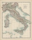
Map of Italy
Fine-Art Print
16" x 20"
$50.99
Ships within 2-3 days
|
|
|
|
|
|
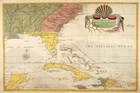
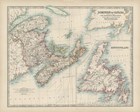
Map of Carolina, Florida & the Bahama Islands
Fine-Art Print
24" x 16"
$56.99
Ships within 2-3 days
|
|
|
|
|
|
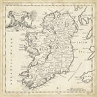
Map of Ireland
Fine-Art Print
24" x 24"
$72.99
Ships within 2-3 days
|
|
|
|

|
|
Black Grey Gold Geo
Fine-Art Print
12" x 16"
$32.99
Ships within 3-5 days
|
|
|
|
|
|
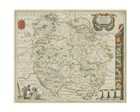
Thvringia Map
Fine-Art Print
15" x 11"
$19.99
Ships within 2-3 days
|
|
|
|
|
|
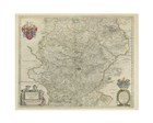
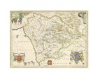
Herefordia Map
Fine-Art Print
15" x 11"
$19.99
Ships within 2-3 days
|
|
|
|
|
|
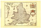
Anglia Map
Fine-Art Print
19" x 13"
$19.99
Ships within 2-3 days
|
|
|
|
|
|
Dvnelmensis Map
Fine-Art Print
15" x 11"
$19.99
Ships within 2-3 days
|
|
|
|

|
|
Illustrated State-Illinois
Fine-Art Print
16" x 20"
$50.99
Ships within 2-3 days
|
|
|
|

|
|
Illustrated State-Virginia
Fine-Art Print
20" x 16"
$50.99
Ships within 2-3 days
|
|
|
|

|
|
Illustrated State-California
Fine-Art Print
16" x 20"
$50.99
Ships within 2-3 days
|
|
|
|

|
|
Illustrated State-Texas
Fine-Art Print
16" x 20"
$50.99
Ships within 2-3 days
|
|
|
|

|
|
Illustrated State-New York
Fine-Art Print
16" x 20"
$50.99
Ships within 2-3 days
|
|
|
|

|
|
Illustrated State-Florida
Fine-Art Print
16" x 20"
$50.99
Ships within 2-3 days
|
|
|
|
|
|
Map of Canada
Fine-Art Print
20" x 16"
$50.99
Ships within 2-3 days
|
|
|
|
|
|
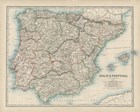
Map of Spain & Portugal
Fine-Art Print
20" x 16"
$50.99
Ships within 2-3 days
|
|
|
|
|
|
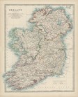
Map of Ireland
Fine-Art Print
16" x 20"
$50.99
Ships within 2-3 days
|
|
|
|
|
|
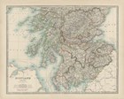
Map of Scotland
Fine-Art Print
20" x 16"
$50.99
Ships within 2-3 days
|
|
|
|
|
|
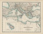
Map of the Mediterranean
Fine-Art Print
20" x 16"
$50.99
Ships within 2-3 days
|
|
|
|
|
|
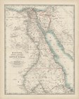
Map of Egypt
Fine-Art Print
16" x 20"
$50.99
Ships within 2-3 days
|
|
|
|
|
|
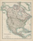
Map of North America
Fine-Art Print
16" x 20"
$50.99
Ships within 2-3 days
|
|
|
|
|
|
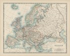
Map of Europe
Fine-Art Print
20" x 16"
$50.99
Ships within 2-3 days
|
|
|
|
|
|
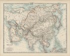
Map of Asia
Fine-Art Print
20" x 16"
$50.99
Ships within 2-3 days
|
|
|
|

|
|
Map of Africa
Fine-Art Print
20" x 16"
$50.99
Ships within 2-3 days
|
|
|
|
|
|
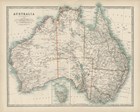
Map of Australia
Fine-Art Print
20" x 16"
$50.99
Ships within 2-3 days
|
|
|
|
|
|
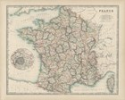
Map of France
Fine-Art Print
20" x 16"
$50.99
Ships within 2-3 days
|
|
|
|
|
|
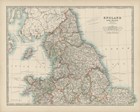
Map of England & Wales
Fine-Art Print
20" x 16"
$50.99
Ships within 2-3 days
|
|
|
|
|
|
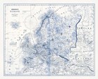
Europe in Shades of Blue
Fine-Art Print
15" x 12"
$35.99
Ships within 2-3 days
|
|
|
|
